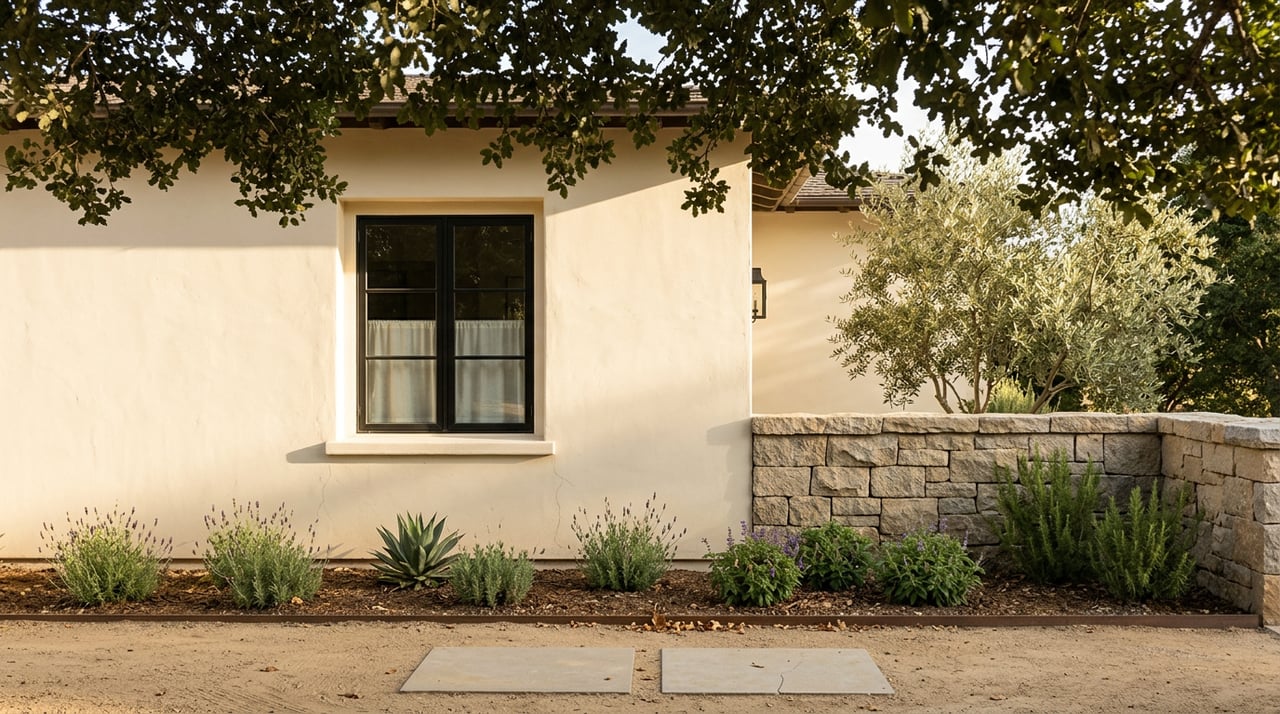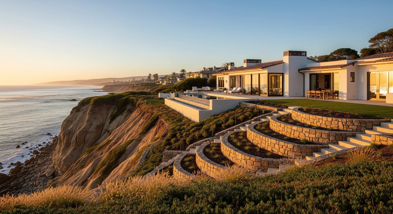
Eyeing an ocean‑view home on a Santa Barbara bluff and wondering how close you can build to the edge? If you are considering Summerland, Padaro, or Montecito, that question matters more than you might think. A clear understanding of coastal bluff setbacks helps you protect your investment, navigate permits, and plan future improvements with confidence. This guide explains what a setback is, how it is decided locally, and what you should review before you buy. Let’s dive in.
Coastal bluff setback basics
A coastal bluff setback is the required horizontal distance between any structure and the top of the coastal bluff. The goal is to reduce risk from bluff retreat, collapse, erosion, storms, and future sea‑level rise. Setbacks keep people and property a safe distance from where the bluff edge is expected to be over time and help protect coastal resources and public access.
In practice, a setback applies to new homes, additions, and sometimes major renovations. It also influences the placement of pools, decks, parking, and accessory structures, including ADUs. There is no single number that works for all parcels. Setbacks are site‑specific and rely on geologic and geotechnical analysis.
Why setbacks matter in Summerland and Montecito
Summerland, Padaro, and Montecito sit on dynamic Central Coast bluffs where natural erosion and slope instability can be active. That reality shapes what you can build and where.
- Setbacks affect usable lot area and the location of the home, pool, decks, and ADUs.
- Most coastal projects require a Coastal Development Permit, which adds time and review.
- Insurance and lending often consider bluff hazards, which can impact coverage and loan terms.
- Resale value and buyer confidence improve when hazard issues are understood and documented.
How setbacks are determined
Scientific inputs
Local agencies rely on licensed geologists and engineers to study site conditions and recommend a geologic setback. Common inputs include:
- Historic erosion rates based on aerial photos, LiDAR, or site records.
- Projected bluff retreat over a chosen planning horizon, often 30 to 100 years.
- Buffers and factors of safety to address uncertainty and episodic failures.
- Site‑specific investigations, including borings, soil testing, and slope stability analyses.
- Sea‑level rise and storm surge projections that can increase erosion or wave attack.
- Geologic mapping and hazard inventories to flag known risk areas.
Formula and design life
A typical approach is: required setback equals projected bluff retreat over the structure’s design life plus a buffer and any extra distance needed for site conditions. The design life can vary by jurisdiction and project type. Two adjacent parcels can have different setbacks due to unique geology and retreat history.
Regulatory framework
Setbacks are guided by statewide and local policy. The California Coastal Act directs development to minimize hazards and protect coastal resources. The California Coastal Commission provides guidance and may review permits. In unincorporated Santa Barbara County, including Summerland, Padaro, and much of Montecito, the County issues Coastal Development Permits and relies on site geotechnical reports and planning policies to set conditions.
Limits on armoring
Hard armoring such as seawalls and revetments is closely controlled. Regulators favor avoiding hazards or relocating development when feasible because armoring can harm beaches and public access. Approval for new armoring is typically limited to protecting existing development when no less‑harmful option is feasible and often requires environmental review and mitigation.
Local process in Santa Barbara County
Jurisdiction and permits
For unincorporated Summerland and Montecito, you apply through Santa Barbara County Planning & Development. Most bluff‑area projects need a Coastal Development Permit, and often a grading and building permit. Discretionary review is common, and some projects involve public hearings or appeals. Complex sites can take several months to a year or more, especially if appeals occur.
Local hazard context
Bluff composition and slopes vary along this coastline. Some areas show seasonal undercutting, slumps, or past slope failures. Regional watershed events and debris flows can influence local slope stability and design choices. County planners typically require a current geotechnical report from licensed professionals.
Typical outcomes and constraints
- Smaller Summerland parcels near the bluff may face tighter building envelopes and require creative design to maintain setbacks.
- Expansions of existing homes close to the edge can be limited or conditioned, especially if additions would increase exposure to hazards.
- Approvals often include monitoring, reassessment triggers, and potential removal or relocation requirements if hazards advance.
What to check before you buy a bluff property
Documents and disclosures
Ask the seller for:
- Any geotechnical or geologic reports, including boring logs and stability analyses.
- Copies of Coastal Development Permits, grading permits, and any variance letters.
- Records for seawalls or revetments, including permits and any enforcement history.
- Insurance claims or damage history tied to erosion, landslides, or coastal storms.
Also review public records:
- County permit history and any recorded conditions for the parcel.
- County hazard maps and recorded notices related to geologic hazards.
Key questions to ask
- Has a recent site‑specific geotechnical report been prepared? What planning horizon and factors of safety were used?
- Is the parcel within mapped hazard zones like slope stability, landslide, tsunami, or FEMA flood areas?
- Are there signs of bluff retreat on or near the parcel, such as undercutting or slumps?
- Are there shoreline protective structures on or adjacent to the site? Were they permitted and in good condition?
- What conditions might the County require for decks, pools, additions, or an ADU near the bluff?
- Would your proposed remodel or addition require a new Coastal Development Permit and an updated geotechnical report?
Financial and valuation effects
- Setbacks reduce buildable area and can limit future additions or an ADU, which influences value.
- Upfront costs may include a geotechnical report and specialized design.
- Long‑term conditions may require monitoring or even removal or relocation if hazards progress.
- Lenders and insurers may require geotechnical information and could adjust terms for higher‑risk sites. Some policies exclude landslide or coastal erosion damage.
Timeline and process
- Start with a pre‑application discussion with County Planning to understand expectations.
- Plan for a geotechnical report early, as it informs design and permit strategy.
- Coastal Development Permits and environmental review can take several months, and complex cases may extend beyond a year, especially if appeals are involved.
- Expect potential long‑term monitoring or reporting obligations as permit conditions.
Key takeaways
- There is no universal setback. Your parcel’s geology and retreat history drive the required distance.
- Modern analyses consider sea‑level rise and storm intensity across a defined planning horizon.
- Permitting is a multi‑step process that often includes a Coastal Development Permit and geotechnical review.
- Smart due diligence upfront protects value and improves your options for future improvements.
If you are evaluating a bluff‑area home in Summerland, Padaro, or Montecito, a tailored plan and the right professional team will help you move forward with clarity. For discreet, fiduciary guidance and coordination with local experts, connect with Jon Perkins for a confidential consultation.
FAQs
What is a coastal bluff setback in Santa Barbara?
- It is the required horizontal distance between a structure and the bluff top, set to reduce risk from erosion, retreat, collapse, storms, and sea‑level rise.
Is there one standard setback for Summerland bluffs?
- No. Setbacks are site‑specific and depend on geology, historic erosion, projected retreat, design life, and regulatory decisions.
How are setbacks calculated for Montecito properties?
- A typical approach adds projected bluff retreat over the structure’s design life to a safety buffer and any site‑specific requirements identified by geotechnical studies.
Can I add a pool or ADU near the bluff edge?
- Possibly, but placement is controlled by the required setback and permit conditions. The County may limit or condition pools, decks, and ADUs near the bluff.
Will Santa Barbara County allow a new seawall to protect my home?
- New armoring is generally discouraged and only considered to protect existing development when no feasible alternative exists, often with mitigation and time limits.
How long do Coastal Development Permits take in this area?
- Timelines vary by site complexity, but several months is common, and complex or appealed projects can extend to a year or more.
Do I need a new geotechnical report for a remodel?
- Often yes. New permits or significant changes usually trigger a requirement for a recent, site‑specific geotechnical report.
Does sea‑level rise change setbacks today?
- Yes. Current guidance typically incorporates sea‑level rise and storm intensity into planning horizons and retreat projections, which can increase required setbacks.